Before the bridge: how Cocoa got to the beach, 1880s through the causeway era
Until 1917 there was no bridge from mainland Cocoa to the barrier island. Crossing meant a ferry. The 1917 swing bridge, the 1925 land-boom causeway, and the Pineda Causeway south of town all changed what was reachable.
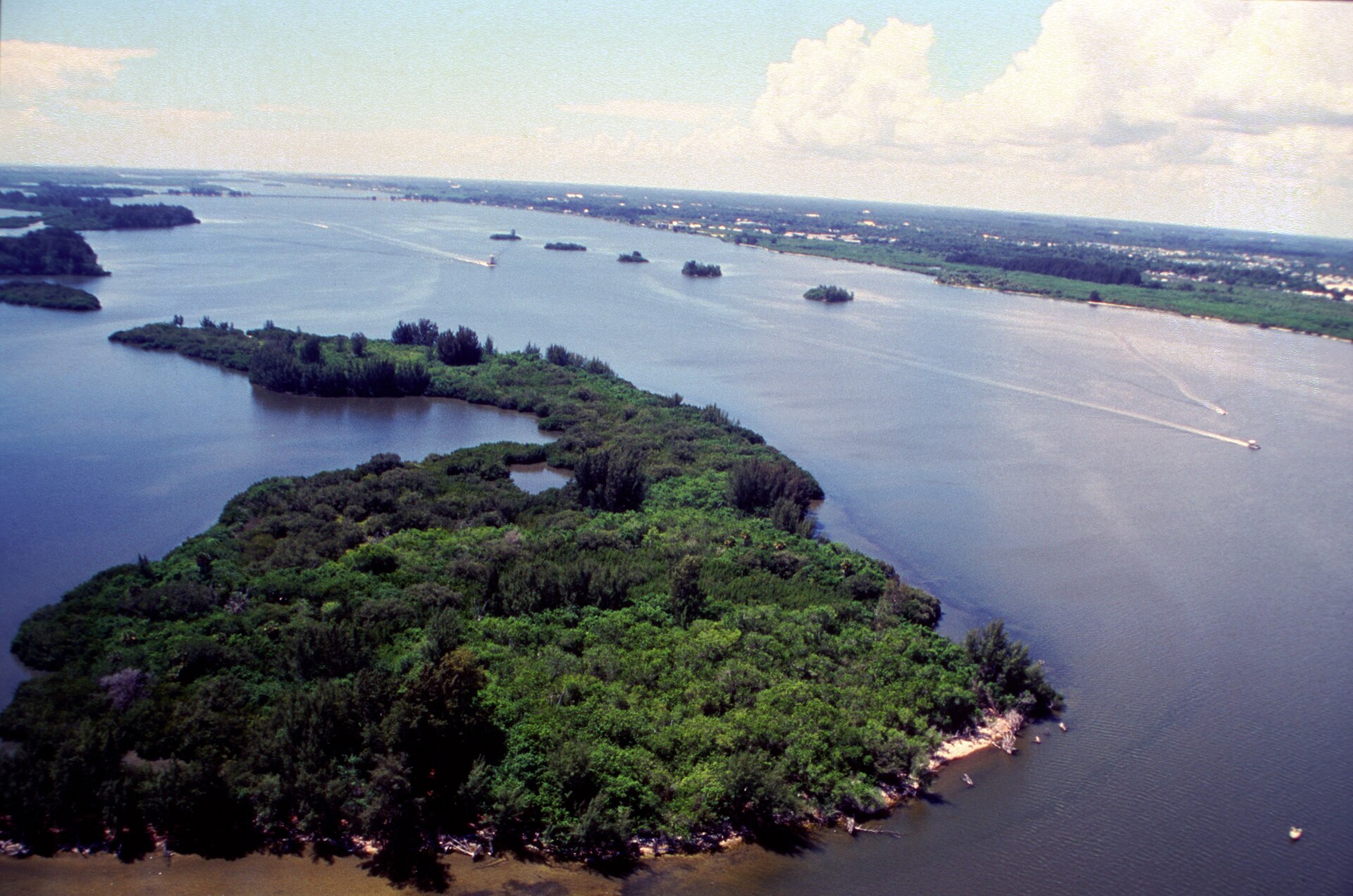
For the first 35 years of Cocoa’s existence as an incorporated city, there was no bridge to the barrier island. If you wanted to get to what is now Cocoa Beach, you took a ferry across the Indian River Lagoon to Merritt Island, then either another ferry or a long sandy track east across Merritt Island and across the Banana River to the barrier island. The crossing took half a day in good weather. In bad weather, you didn’t go. The barrier island was mostly empty palmetto scrub, valuable to no one except mosquitoes and a few squatters.
Three things changed that: the 1917 wooden swing bridge from Cocoa to Merritt Island, the 1925 land-boom causeway to the barrier island, and the 1969 Pineda Causeway that gave the southern half of Brevard County a second crossing. By 1970, the barrier island was an integrated suburb of mainland Brevard, and Cocoa Beach was a city of 11,000. The bridges built that.
The ferry era
The Cocoa-to-Merritt Island ferry ran from a dock at the foot of King Street, on what is now the Cocoa Riverfront Park (its own piece). The crossing was about 1.5 miles across the lagoon to the western edge of Merritt Island, near today’s State Road 520.
The ferry was a small steam-powered scow capable of carrying maybe a dozen people or two or three horse-drawn wagons. Operator schedules were irregular, three to five crossings a day, weather dependent. Fare in 1900 was 25 cents per person, 50 cents per horse, $1 per wagon. The U.S. Postal Service contracted with the ferry operator for mail delivery to Merritt Island residents (a few dozen families).
To get from the eastern edge of Merritt Island to the barrier island in 1900, you crossed the Banana River, narrower than the Indian River and wadable in some seasons, but generally requiring a small boat. There was no formal ferry on the Banana side; you negotiated with a fisherman or you didn’t go.
This was the state of access until the 1910s.
The 1917 swing bridge
The first bridge across the Indian River Lagoon at Cocoa opened in October 1917. It was a wooden swing bridge, a center section that rotated horizontally on a pier to let lagoon boat traffic pass, running roughly parallel to today’s State Road 520. The structure was built and maintained by Brevard County under a bond issued in 1915.
The bridge was a single-lane wooden span with periodic turnouts to allow opposing traffic. Surface was wood planks; you could hear cars coming from a half-mile. Tolls were charged: 25 cents per car, less for pedestrians. Toll collection was contracted out, and the operator lived in a small toll house at the western (Cocoa) end of the span.
The 1917 bridge ended the ferry era but did not yet open the barrier island. From the eastern end of the bridge on Merritt Island, you still had to cross the Banana River to reach what is now Cocoa Beach. That crossing was the developer Gus Edwards’s problem.
Gus Edwards and the 1925 causeway
Gus Edwards was a Cocoa-based developer who had bought significant acreage on the barrier island around 1920 and intended to subdivide it as a beach resort community. The barrier island in 1920 was unincorporated, undeveloped, and accessible only by a difficult Banana River crossing. Edwards needed a road.
He built one. The Cocoa Beach Causeway, a sand-and-shell causeway running across the Banana River from eastern Merritt Island to the barrier island, with a small wooden swing bridge at the deepest part of the channel, opened in 1924, in time for the 1924–25 winter season that was the peak of the Florida land boom. Edwards’s company financed the causeway directly and recouped the cost through lot sales.
The result was the barrier island’s first real burst of settlement. Lots that had been worthless in 1922 sold for $500–$2,000 each in 1925. The land bust that followed in 1926 left many of these lots half-built and abandoned; Cocoa Beach incorporated as a city in 1925 with a population of fewer than 100, and didn’t recover real growth until World War II and the Banana River Naval Air Station (later Patrick Air Force Base).
The 1924 causeway and the 1917 bridge together formed the only mainland-to-beach route until 1969.
The Pineda Causeway
The Pineda Causeway is the second crossing of the Indian River south of Cocoa, running from southern Rockledge across to north Patrick Air Force Base / north Satellite Beach. It opened to traffic in November 1969 as State Road 404.
Why a second crossing? By the late 1950s, NASA’s expansion at Cape Canaveral and Kennedy Space Center had made the population of southern Brevard County explode. Satellite Beach, Indian Harbour Beach, and Indialantic were filling up with NASA contractors, military families, and retirees. The single Cocoa-Cocoa Beach crossing was saturated. Florida Department of Transportation studies in the early 1960s identified a need for a southern bridge.
The Pineda Causeway took its name from José Antonio Pineda, the Spanish explorer who in 1513 sailed along the Florida east coast (though there’s no specific evidence Pineda personally reached this stretch; the name was a 20th-century selection). The causeway is roughly 4 miles long including approach roads, with the bridge over the navigable Indian River channel rebuilt and widened in 2006.
The Pineda was, and is, the principal traffic route for residents of the Rockledge / Viera / Suntree area to reach the beach. It split the Cocoa-Cocoa Beach traffic in half and made the southern beach communities effectively independent of mainland Cocoa.
What the bridges did to mainland Cocoa
The 1917 bridge gave mainland Cocoa direct connection to Merritt Island, opening citrus land on Merritt that had previously required a ferry to reach. Cocoa briefly became the commercial center for Merritt Island farming.
The 1924 Edwards causeway turned Cocoa Beach into a real place, eventually. The 1925 land bust delayed it by twenty years, but the bridge made the barrier island’s eventual development possible.
The 1969 Pineda Causeway pulled commercial activity away from mainland Cocoa. Once Rockledge / Viera / Satellite Beach residents could reach the beach without driving through Cocoa, mainland Cocoa lost some of its function as a transit corridor. By 1980, what had been Cocoa’s principal commercial strip on Brevard Avenue was struggling against newer shopping centers along US-1 in Rockledge and along State Road 520 east of the bridge. Cocoa Village’s 1980s revival was a response to that pull.
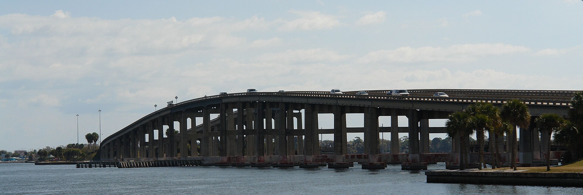
What you cross today
The 1917 wooden bridge is long gone. The current State Road 520 / Hubert Humphrey Bridge over the Indian River dates to 1971, with a major rehabilitation in 2014. The Banana River crossing has been rebuilt several times, most recently in 2003.
The Pineda Causeway bridge over the Indian River main channel dates to 2006, replacing the original 1969 structure that had reached the end of its design life.
The original 1924 Edwards-built sand causeway across the Banana River was rebuilt as engineered fill in the 1950s and is now substantially submerged in the modern causeway alignment, but the route is the same.
Further Reading
- The Gulf: The Making of an American Sea by Jack E. Davis
- Pioneer Life in Southeast Florida by Charles W. Pierce
- Florida: A Short History by Michael Gannon
Sources
- Brevard County Clerk of Court, bond issuance records, 1915 and 1922.
- Florida Department of Transportation, bridge inventory and historical records, State Road 520 and State Road 404.
- Cocoa Tribune, 1915–1925, bridge construction coverage (microfilm via Brevard County Library).
- City of Cocoa Beach, official municipal history, founding and causeway records.
- Patrick Air Force Base, historical records on access roads, 1940s–1970s.
- Florida Historical Quarterly, articles on Florida land boom era in Brevard County.
- National Hurricane Center / NOAA, hurricane damage assessments for the 1924 and 1933 storms affecting the Cocoa causeway.
- U.S. Coast Guard, Cocoa Beach Causeway navigability records.
As an Amazon Associate we earn from qualifying purchases.